
JINVERSE DIGITAL / OWNED WORK / NIGHT ROUTE
NIGHT ROUTE — A wayfinding system with real route states
Spatial information & wayfinding
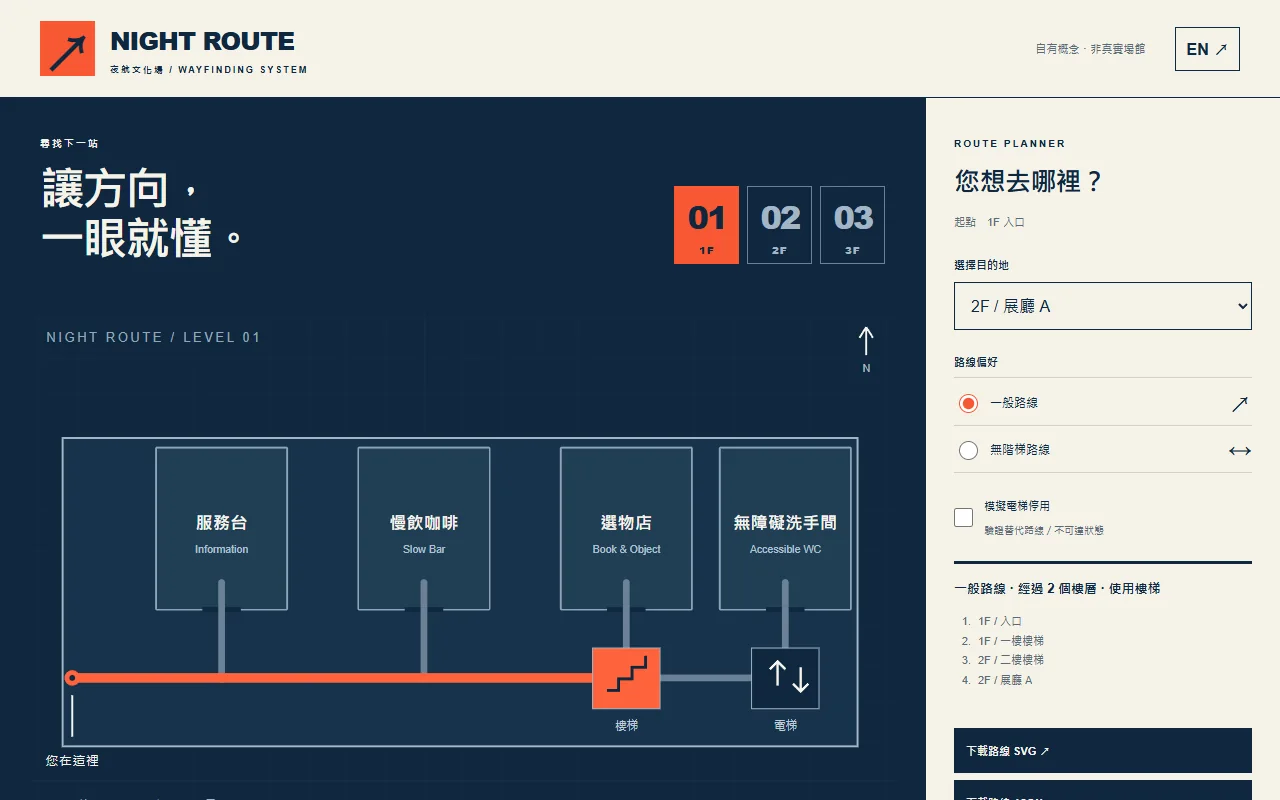
An owned fictional-venue wayfinding system: three floors, 11 destinations, bilingual route controls, step-free and unavailable states, editable SVGs and a PDF proof.
Self-initiated studio work, not a client commission. No adoption, revenue or business uplift is claimed.
The design problem
A venue identity must remain useful when someone needs to get somewhere. NIGHT ROUTE connects visual hierarchy, bilingual place names, physical-sign concepts and an interactive route graph. An unavailable route is treated as a design state instead of hiding the problem.
The implementation
A shared graph describes three floors and 11 destinations. Dijkstra selects demonstration routes; step-free mode excludes stair edges and an elevator-disabled state makes upper-floor routes explicitly unavailable. Maps, icons and sign layouts remain editable vectors, while the current route can be exported as SVG or structured JSON.
Deliverables to inspect
- Three-floor map interface with 11 destinations, English/Traditional Chinese controls, normal and step-free routes, and elevator-disabled handling.
- Twelve editable SVG icons, three SVG floor maps and three bilingual sign layouts, plus a seven-page A3-scale PDF review proof.
- Route JSON and current-floor SVG download, graph data, sign schedule and a source-delivery ZIP.
Scope and limits
- The venue is fictional. No site measurement, accessibility certification, installation, structural review or building-code compliance is established. The PDF is a reduced-scale review proof, not fabrication release.
- Route weights are illustrative, not measured meters or travel times. Mobile maps use local horizontal scrolling to preserve label size; the application is not a real-time indoor positioning service.